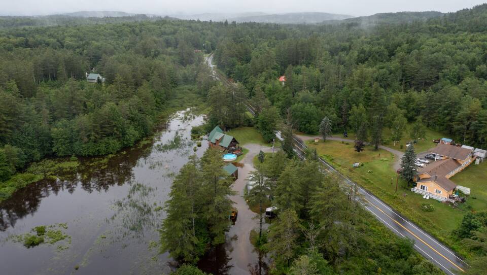


Flood warnings are still in effect in Vermont as the state has experienced torrential downpours, rising rivers and streams and emergency evacuations of people stuck in their homes.
No flood-related deaths or injuries had been reported in Vermont as of Tuesday morning, according to the Associated Press.
But the amount of rain falling over a short period of time is certainly “super unusual,” GBH meteorologist Dave Epstein said.
Some of the rain totals in Vermont from yesterday. Lots of flooding. @jersiegel pic.twitter.com/H0DQF9z0Ck
— Dave Epstein (@growingwisdom) July 11, 2023
“We have not seen rainfall like this since Irene,” Vermont Gov. Phil Scott said, referencing 2011’s Tropical Storm Irene in August 2011. “We’re getting just as much rain, if not more. It’s going on for days. That’s my concern. It’s not just the initial damage. It’s the wave, the second wave and the third wave.”


When talking about these weather events, people may use terms like “100-year flood.” That’s a term often used by insurance companies to determine how likely that amount of flooding is to occur, Epstein said.
“It just gives you a percentage of, you know, it’s a 1% chance this would happen, or a 1/10 of 1% chance that this would happen,” he said. “And when you start getting these events happening more frequently that are supposed to be a 1% chance, that’s when we start to evoke things like part of the changing climate — that these events get closer and closer together.”
Winooski River up near Burlington, Vermont not forecast to crest until later this morning. Otter Creek near Rutland on its way down but still in major flooding after being close to a record. #Floods #Vermont pic.twitter.com/fovbiZQvcI
— Dave Epstein (@growingwisdom) July 11, 2023
For areas along rivers and streams, flood risks continue after the rain has stopped, Epstein said.
“You get the amount of water that comes down into the streams,” he said. “The small streams, they peak first. But all that small stream water has got to go into the bigger stream. So it takes a little while for those streams to start peaking.”
Water levels will likely peak Tuesday or Wednesday. That means people should exercise caution around them — and stay away from flooded areas, Epstein says.
Materials from the Associated Press were used in this report.


