There's an enormous temperature contrast moving across the nation today. This contrast is creating a very strong jet stream and that will move up and over New England early Friday into Friday afternoon. The most remarkable part of the upcoming storm is going to be the wind, but plenty of rain will accompany those gusts.
The overall timetable for the storm is this: Rain will arrive Thursday evening, with winds picking up overnight. It will pour hard Friday morning with lots of wind and even the chance of thunder. A lull in the rain will be followed by a round of early afternoon showers. Friday night will bring clearing and colder weather with less wind.
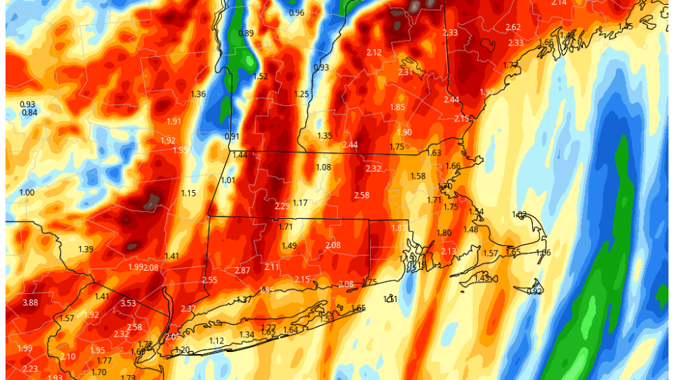
There will be anywhere from 1 to 2 inches of rain, with some places receiving nearly 3 inches. But even with that amount of water, I'm not expecting anything beyond some street and basement flooding. Any stream or river issues would be minor.

Winds will be strongest between 5 and 9 a.m. Friday as rain soaks the region. Those tiny raindrops falling from the clouds can actually pull the strong winds down to the surface. You may notice tomorrow morning as it's raining hardest, it's also windiest. The rain will temporarily end late morning, followed by a little bit of a lull and then another briefer and less intense round of showers in the early afternoon before the precipitation comes to a complete end.
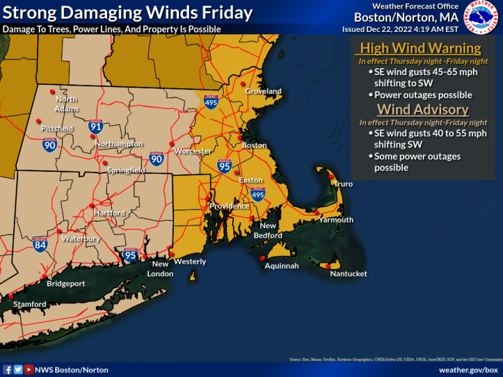
There is a high wind warning for Eastern Massachusetts and a wind advisory further west. On Friday morning, winds could gust at over 60 mph, especially right along the coastline and in slightly higher elevations. I do think that the strongest wind will be over by 10 a.m. This doesn't mean it's not going to be windy after that, but when you look at peak wind gusts they should occur within a couple of hours of 7 a.m.

Electricity supplier Eversource told GBH News it is preparing for the possibility of significant power outages. Crews have been cutting down branches that threaten power lines and preparing service vehicles in advance of the storm, but the utility says outages lasting more than two days remain possible.
Massport said Logan Airport is equipped to handle the storm locally, but air travel will likely be affected by backups at airports in the Midwest.
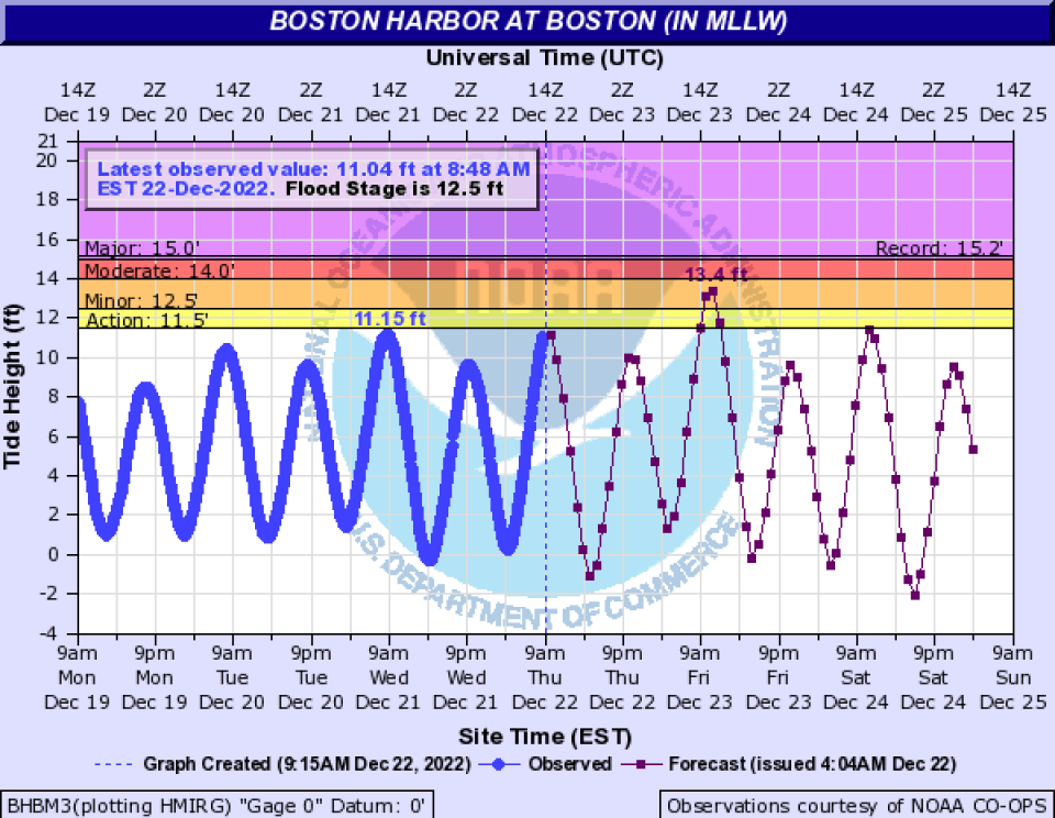
Coastal flooding is also likely at the time of high tide Friday morning. You can see on the image below how Boston Harbor is forecast to have minor to moderate flooding. This scenario will be repeated across many coastal communities.

Temperatures are going to rapidly fall from their highs mid-morning on Friday into the teens on Saturday morning. Because the winds will be so strong, I don't think we're going to have a flash freeze issue. The wind tends to dry the roads out pretty fast. However, there could be some residual icy spots from big puddles that have frozen. Windshields will feel near zero on Saturday morning.
Saturday is just blustery and cold with temperatures in the mid-20s.
Christmas Day is also cold with temperatures in the mid- to upper-20s along with a persistent breeze.


